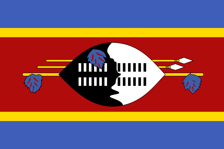
Eswatini
Country
Member state of the United Nations.[1]
- Land area
- 17,200 km²[6]
- Total area
- 17,364 km²[7] land and water
- Land borders
- Mozambique, South Africa[12]
Parts of Eswatini
Loading 4 places.
Through time
345,337 in 1960, 1,256,174 in 2025
Show as a table
| Year | Population |
|---|---|
| 1960 | 345,337 |
| 1961 | 353,264 |
| 1962 | 361,365 |
| 1963 | 369,759 |
| 1964 | 378,656 |
| 1965 | 388,336 |
| 1966 | 398,766 |
| 1967 | 409,031 |
| 1968 | 419,147 |
| 1969 | 429,875 |
| 1970 | 441,216 |
| 1971 | 453,183 |
| 1972 | 465,788 |
| 1973 | 479,038 |
| 1974 | 492,988 |
| 1975 | 507,673 |
| 1976 | 523,330 |
| 1977 | 540,348 |
| 1978 | 558,446 |
| 1979 | 577,199 |
| 1980 | 596,644 |
| 1981 | 616,808 |
| 1982 | 637,652 |
| 1983 | 658,957 |
| 1984 | 680,783 |
| 1985 | 706,196 |
| 1986 | 734,732 |
| 1987 | 763,811 |
| 1988 | 799,798 |
| 1989 | 837,800 |
| 1990 | 872,428 |
| 1991 | 908,189 |
| 1992 | 943,416 |
| 1993 | 971,318 |
| 1994 | 971,212 |
| 1995 | 970,433 |
| 1996 | 989,841 |
| 1997 | 1,006,635 |
| 1998 | 1,019,653 |
| 1999 | 1,030,782 |
| 2000 | 1,041,414 |
| 2001 | 1,051,064 |
| 2002 | 1,059,441 |
| 2003 | 1,066,700 |
| 2004 | 1,073,159 |
| 2005 | 1,079,022 |
| 2006 | 1,084,436 |
| 2007 | 1,090,705 |
| 2008 | 1,098,091 |
| 2009 | 1,105,153 |
| 2010 | 1,111,650 |
| 2011 | 1,117,833 |
| 2012 | 1,123,863 |
| 2013 | 1,129,990 |
| 2014 | 1,136,299 |
| 2015 | 1,142,813 |
| 2016 | 1,149,507 |
| 2017 | 1,158,195 |
| 2018 | 1,168,929 |
| 2019 | 1,179,874 |
| 2020 | 1,192,729 |
| 2021 | 1,206,593 |
| 2022 | 1,218,917 |
| 2023 | 1,230,506 |
| 2024 | 1,242,822 |
| 2025 | 1,256,174 |
Learn more
- Simple English Wikipedia easier reading
- Wikipedia
- Wikidata the structured data behind many facts here
Codes
Changes to this page's data
No changes recorded since the dataset of 5 November 2026.
Sources
- United Nations: Member States Published directly by the source.
- Wikidata: Eswatini (Q1050), capital: Lobamba Wikidata statement that does not cite a source yet.
- Wikidata: Eswatini (Q1050), capital: Mbabane Wikidata statement that does not cite a source yet.
- World Bank, World Development Indicators: Population, total (SP.POP.TOTL) Published directly by the source.
- Wikidata: Eswatini (Q1050), population Wikidata statement that does not cite a source yet.
- World Bank, World Development Indicators: Land area (sq. km) (AG.LND.TOTL.K2) Published directly by the source.
- Wikidata: Eswatini (Q1050), area Wikidata statement that does not cite a source yet.
- Wikidata: Eswatini (Q1050), official language: English Wikidata statement that does not cite a source yet.
- Wikidata: Eswatini (Q1050), official language: Swazi Wikidata statement that does not cite a source yet.
- Wikidata: Eswatini (Q1050), currency: lilangeni Wikidata statement that does not cite a source yet.
- Wikidata: Eswatini (Q1050), continent: Africa Wikidata statement that cites its own sources.
- Cites: https://www.workwithdata.com/place/eswatini, retrieved 10 October 2024
- Natural Earth: Admin 0 countries, 1:50m Published directly by the source.
- Wikidata: Eswatini (Q1050), instance of Wikidata statement that does not cite a source yet.
- Wikidata: Eswatini (Q1050), official name Wikidata statement that cites its own sources.
- Cites: Kingdom of Eswatini Change Now Official, retrieved 27 May 2018
- Wikidata: Eswatini (Q1050), official name Wikidata statement that does not cite a source yet.
- Wikidata: Eswatini (Q1050), ISO 3166-1 alpha-2 code Wikidata statement that does not cite a source yet.
- Wikidata: Eswatini (Q1050), ISO 3166-1 alpha-3 code Wikidata statement that does not cite a source yet.
- Wikidata: Eswatini (Q1050), ISO 3166-1 numeric code Wikidata statement that does not cite a source yet.
Flag image: Flag of Eswatini.svg, Public domain, Sobhuza II, via Wikimedia Commons.